Map themes
The original version of this document is located at https://docs.qfield.org/how-to/qfield-interface/map-themes
Map themes
The beautiful thing about GIS is that maps are dynamic.
Layers can individually be shown and hidden and information can be presented more or less prominently based on the task at hand.
This is what Map themes are for.
Creating a Map Theme
🖥️ Desktop preparation
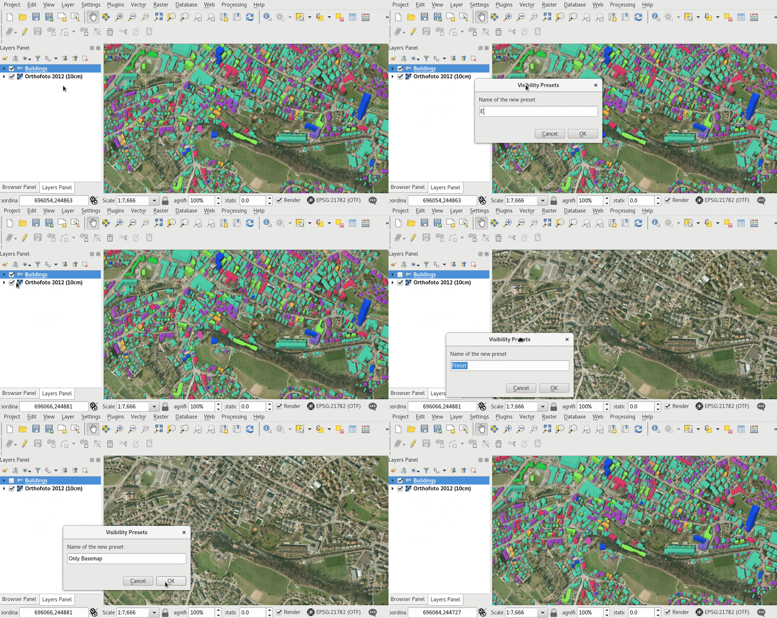
Creating a Map Theme in QGIS is a very simple task.

- Style the map and layers to your requirements.
- Save it as a named Map Theme.
- Load the project on your device and change the active Map Theme.
Change the active Map Theme
📱 Fieldwork
If you defined map themes for your project in QGIS, you can switch between them from the side “Dashboard”.
Use the Map themes combobox to chose the active theme.
Related Articles
Map Decorations
The original version of this document is located at https://docs.qfield.org/how-to/qfield-interface/decorations Map Decorations ?️ Desktop preparation If you want to customise your project with “Decorations” in QField this can be done but you need ...Map styling
The original version of this document is located at https://docs.qfield.org/how-to/qfield-interface/map-styling Map styling All style settings from QGIS are directly supported by QField. This includes all renderer types like graduated, categorized, ...Interact with the map
The original version of this document is located at https://docs.qfield.org/how-to/qfield-interface/map-interaction Interact with the map Here are some of the possible interactions with the map in QField. Map legend ? Fieldwork Open the side ...Geologic Mapping
The original version of this document is located at https://docs.qfield.org/success-stories/geologic-mapping Geologic Mapping with QField By Rohanna Gibson, Structural Geologist, Terrane Geoscience Goal To collect new data on bedrock geology and view ...Heritage Impact Assessment
The original version of this document is located at https://docs.qfield.org/success-stories/heritage-impact-assessment Heritage Impact Assessment using QField From QGIS to QField and Vice Versa: How the New Android Application Is Facilitating the ...