Data Source and project paths
The original version of this document is located at https://docs.qfield.org/how-to/project-setup/data_source_and_project_paths
Data Source & project paths
You can save and store your projects and layers in multiple ways and formats.
It is common best practice to save all your project related data in the same folder as the QGIS project unless you are making use of shared datasets.
Furthermore, while working in a project with many domain tables etc. it may be preferable to hide some of the layers from the collector’s eyes to make the user experience more manageable.
Data source configuration
Often, you do not need to access the attributes of all the feature layers or view the value relation tables of your projects.
You can achieve that by setting the right “layer capabilities”.
Workflow
🖥️ Desktop preparation
- In the menu toolbar click on Project > Properties… > Data Sources
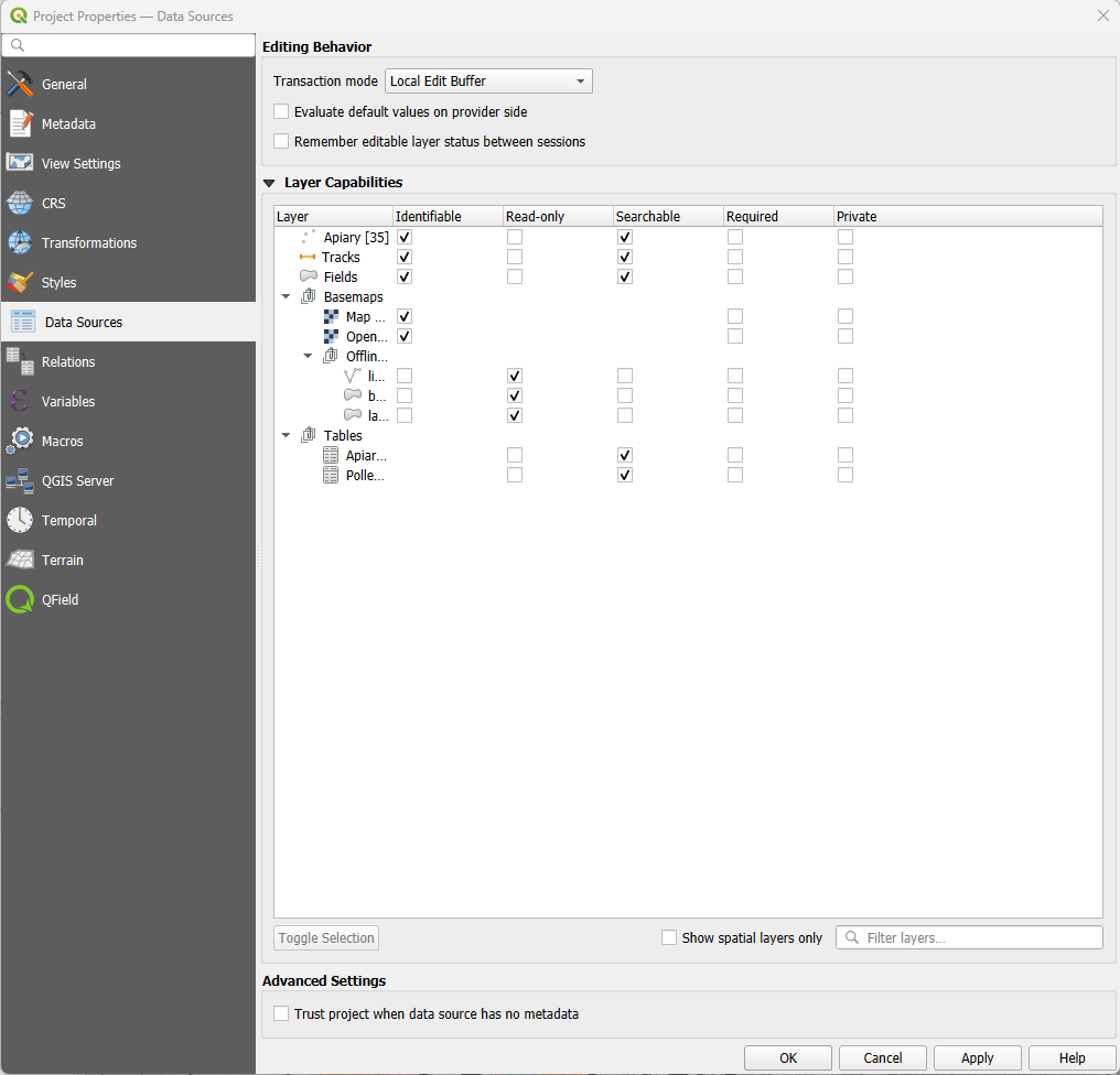
- Identifiable: If unchecked the objects of the layer can no longer be identified in QGIS and QField
- Read-Only: If checked a layer can no longer be added, edited or deleted.
- Searchable: If checked the attributes of the layer can be found in the search bar and be accessed for expressions.
- Required: If checked the layer will always be visible and cannot be turned off by any user in the map canvas.
- Private: If checked the layer is hidden from the project’s legend or layer tree.
Relative Project path
It is a good practice to set all your file paths of your datasets and attachments to “relative” making your project easily transferrable.
To manually transfer and synchronize your QGIS project to QField or another client, you will need such a portable version of your QGIS project file (.qgs, .qgz).
Workflow
🖥️ Desktop preparation
- Direct to Project > Properties > General
- Insure that the Save paths is set to Relative

- Insure also that all required data files are in the same folder as the QGIS project or in a subfolder.
You can learn more how to prepare your projects for fieldwork in Get Started with QFieldCloud (recommended) or Get Started with QFieldSync tutorials.
Related Articles
Portable project
The original version of this document is located at https://docs.qfield.org/how-to/advanced-how-tos/movable-project Portable project To manually synchronize your QGIS project, you will need a portable version of your QGIS project file (.qgs, .qgz). ...Data collection of rural water supply systems
The original version of this document is located at https://docs.qfield.org/success-stories/rwanda-rural-water Data collection by QGIS/QField for O&M work of rural water supply systems in Rwanda By Rural Water and Sanitation Services ...Project creation in QFieldCloud
The original version of this document is located at https://docs.qfield.org/get-started/tutorials/create-project-qfc Creating Projects in QFieldCloud There are multiple options available to initialize and build a project in QFieldCloud: Using QGIS ...Multilingual project support
The original version of this document is located at https://docs.qfield.org/how-to/advanced-how-tos/multilingual-projects Multilingual Project Support in QField QField supports for Project Localization, meaning that a single QGIS project file ...Supported data formats
The original version of this document is located at https://docs.qfield.org/reference/data-format Supported Data Formats QField supports a wide variety of formats via QGIS data providers and GDAL. This page offers a non-exhaustive list of supported ...