Improving Efficiencies in Ecological Surveying
The original version of this document is located at https://docs.qfield.org/success-stories/ecological-surveying
Improving Efficiencies in Ecological Surveying using QField
By Ryan Bell, GIS Consultant, Delta-Simons Environmental Consultancy
Goal
To conduct ecological surveying more efficiently than has been
previously achieved through traditional non-digital techniques, using
QField as a medium for standardised and flexible field data collection.
Project Requirements
To facilitate effective field work, regular consultation with the
Ecology team is required to ensure that QField projects are prepared
appropriately. Firstly, basemaps comprising aerial imagery and proposed
development plans are prepared by georeferencing and constructing
pyramids in QGIS. Point, line and polygon vector layers are then created
to support digitisation and associated data collection. Using a range of
widgets, attribute fields are customised to meet the requirements of the
Ecology team. These include:
Style
: drop-down list of selectable styles tailored for conducting
ecological surveys
Scale
: drop-down list of selectable scales for point and line feature
Info
: space for inserting a feature description
Image
: location for images to be captured and stored
Geometry
: contains self-populated geometry values, e.g. area, perimeter,
length
Timestamp
: records the time and date that a feature was created/last modified
Result
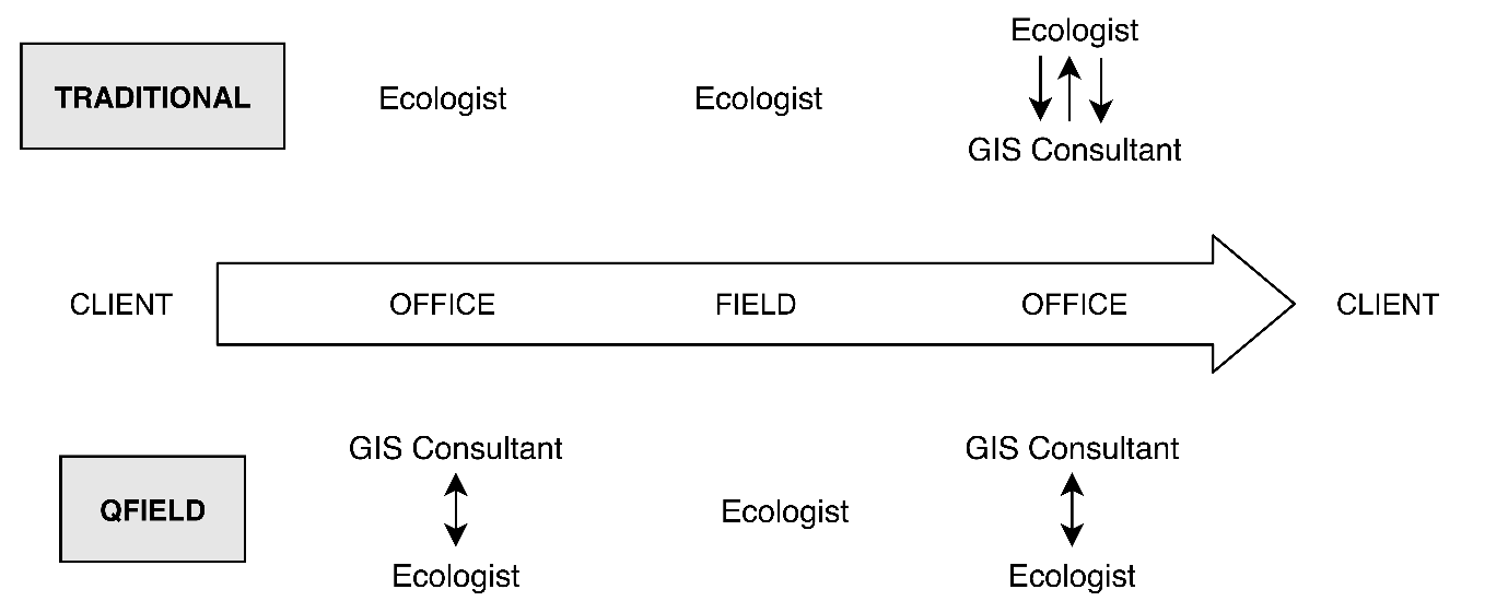
Delta-Simons are saving approximately 40% of the time previously
consumed by traditional ecological field data collection. QField has
significantly improved the ecological surveying workflow by:
- Removing the need to recreate GIS outputs from physical drawings
- Reducing the overall amendments required for GIS outputs
- Improving communication channels (see Figure 1.)
- Improving the accuracy and quality of data
 {width=”400px”}
Related Articles
Data collection of malaria transmitting mosquitoes
The original version of this document is located at https://docs.qfield.org/success-stories/mosquito-malario-ground-truth-data-collection Use of Qfield in the context of ground-truth data collection work of malaria transmitting mosquitoes By Paul ...Get started with QField and QFieldCloud
The original version of this document is located at https://docs.qfield.org/get-started/index Get started with QField and QFieldCloud QField What is it? QField is an open-source application that allows painless fieldwork and synchronisation with your ...All about GPS, GNSS and NTRIP
The original version of this document is located at https://docs.qfield.org/how-to/navigation-and-positioning/gnss Positioning (GNSS) QField is capable to show your live position using several sources: Either by using the internal GNSS (Global ...