Standalone datasets
The original version of this document is located at https://docs.qfield.org/how-to/advanced-how-tos/standalone-datasets
Standalone datasets
QField is able to directly open vector data and raster datasets without the need for a QGIS project.
Supported standalone dataset formats
The supported vector formats are:
- GeoPackage datasets (.gpkg);
- GeoJSON (.geojson, .json);
- KML (.kml, .kmz);
- Shapefile (.shp);
- GPS Exchange (.gpx);
- Geography Markup Language (.gml);
- MapInfo (.mif);
- SpatiaLite (.db, .sqlite); and
- FlatGeoBuf (.fgb)
The supported raster formats are:
- GeoTIFF (.tif, .tiff);
- Geospatial PDF (.pdf);
- JPEG2000 (.jp2);
- JPEG (.jpg, .jpeg);
- PNG (.png); and
- WebP (.webp)
- VRT (Virtual Raster) (.vrt)
Supported point cloud formats:
- LAS/LAZ (.las, .laz)
- COPC (Cloud Optimized Point Cloud)
Note
QField can handle several standalone datasets compressed into one ZIP archive; in this scenario, each dataset will be added as individual layers in QField.
Opening an vector or raster dataset
📱 Fieldwork
Please read the storage access documentation to learn more on how standalone datasets are opened on your specific device.
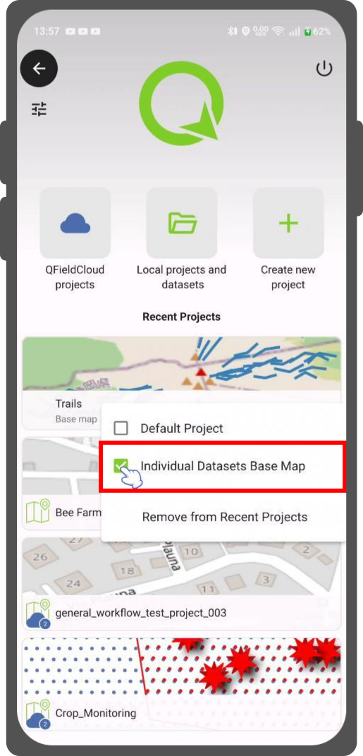
Using a project as “base map” for standalone datasets
📱 Fieldwork
By default, the datasets will be overlaying an OpenStreetMap XYZ layer. It is however possible to customize that by selecting a project stored onto the device QField is running that will act as a base map.
Workflow
- Direct to your project landing page.
- Press long on the project you want to have as a basemap
Related Articles
Shared datasets
The original version of this document is located at https://docs.qfield.org/how-to/advanced-how-tos/shared-datasets Shared datasets It is possible to use layers stored in a single location — referred to as “shared datasets folder” — across multiple ...Project selection
The original version of this document is located at https://docs.qfield.org/how-to/general/projects Project selection QField has a file selector that allows to open a project from the device locally. To open files from the cloud see QFieldCloud. Note ...Storage
The original version of this document is located at https://docs.qfield.org/how-to/project-setup/storage QField Storage Management On the QField homescreen, users are presented with two options to open a project. QFieldCloud projects: The first ...Portable project
The original version of this document is located at https://docs.qfield.org/how-to/advanced-how-tos/movable-project Portable project To manually synchronize your QGIS project, you will need a portable version of your QGIS project file (.qgs, .qgz). ...Data Source and project paths
The original version of this document is located at https://docs.qfield.org/how-to/project-setup/data_source_and_project_paths Data Source & project paths You can save and store your projects and layers in multiple ways and formats. It is common best ...