Print to PDF
The original version of this document is located at https://docs.qfield.org/how-to/data-collection/print-to-pdf
Print to PDF
It’s possible to export laid out maps as PDF document through project print layouts
configured within QGIS.
Usage
📱 Fieldwork
Printing to PDF is available through QField’s main menu bar in the side “Dashboard”.
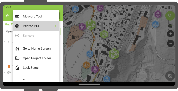
If the opened project has a single print layout defined, selecting the “Print to PDF”
menu will immediately launch an export of the layout to PDF. If more than one print
layout is present, a submenu will appear listing all the available layouts to choose from.
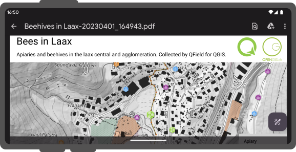
Once the print layout has been exported, QField will allow users to open and view the
created PDF document.
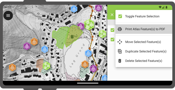
Feature-Driven Atlas Print
You can also print an atlas-driven layout by selecting features from vector layers acting as coverage layers.
To do so, identify features on the map by tapping on the canvas and hold-press on a feature in the list to toggle the (multi-)feature selection mode.
Once the desired features are selected, click on the 3-dotted menu (⋮) button and select Print Atlas Feature(s) to PDF.
It is possible to print a single atlas feature through the feature form by clicking on the
3-dotted menu (⋮) button and selecting the Print Atlas Feature to PDF.
Related Articles
Heritage Impact Assessment
The original version of this document is located at https://docs.qfield.org/success-stories/heritage-impact-assessment Heritage Impact Assessment using QField From QGIS to QField and Vice Versa: How the New Android Application Is Facilitating the ...Standalone datasets
The original version of this document is located at https://docs.qfield.org/how-to/advanced-how-tos/standalone-datasets Standalone datasets QField is able to directly open vector data and raster datasets without the need for a QGIS project. Supported ...Variables
The original version of this document is located at https://docs.qfield.org/how-to/advanced-how-tos/variables Variables QField allows users to add and edit expression variables. These can be used for a wide range of applications, including ...Simple attribute form configuration
The original version of this document is located at https://docs.qfield.org/how-to/project-setup/attributes-form Attribute form Before you go into the field, you will have to configure your forms - the fields that the user will see in the fields. You ...Projects
The original version of this document is located at https://docs.qfield.org/reference/qfieldcloud/projects Projects Projects are the main data containers on QField and QFieldCloud. Users can create any number of projects. Projects must contain a ...